
Bailey's Crossroads ZIP Code Directory Coverage
Mail for Bailey's Crossroads commonly uses 22041, with 22044 appearing in the nearby shared corridor and 22042 appearing in nearby Seven Corners and Annandale-area records. These are research-scope labels, not claims that every address in each delivery area falls inside the Bailey's Crossroads Census-designated place. The postal result needs a second check in Fairfax County MAR or iCare. The coverage table keeps the record-search question tied to the specific address rather than treating a shared ZIP as a resident list.
| ZIP | Areas Covered | Post Office | Notes |
|---|---|---|---|
| 22041 | Core Bailey's Crossroads; Falls Church mailing city often appears | Bailey's Crossroads Post Office | Verify county jurisdiction for the individual address. |
| 22044 | Adjacent or shared Bailey's Crossroads-Seven Corners corridor in some county documents | Not identified in the research | Not every 22044 address is in Bailey's Crossroads. |
| 22042 | Nearby Seven Corners and Annandale-area records | Not identified in the research | Use only after parcel or locality confirmation. |
| 22046 | Primary ZIP for the independent City of Falls Church | Not a default local ZIP | Do not treat it as a Bailey's Crossroads default. |
USPS identifies the delivery ZIP for a complete address. Fairfax County GIS identifies the county address and jurisdiction. The Census identifies a statistical CDP. Each belongs in a Bailey's Crossroads ZIP search, but none substitutes for the other. No authoritative ZIP-polygon-to-CDP or parcel crosswalk was located, so a coverage claim should remain at the address level.
Note: A shared delivery ZIP can support a mailing address but cannot establish a resident's county, CDP, precinct, or parcel.
Bailey's Crossroads ZIP Code Geography
Bailey's Crossroads is an unincorporated Fairfax County community and Census-designated place, not the independent City of Falls Church. A Falls Church mailing city can therefore occur on a Fairfax County address. The City of Falls Church address finder makes the same caution: not every Falls Church mailing address lies inside the independent city. For a Bailey's Crossroads ZIP code directory search, preserve the original mailing label while checking MAR's jurisdiction field and the parcel record.
The local geography also has different overlays. The Crossroads-Seven Corners revitalization area follows the Route 7 and Route 244 corridor and covers about 431 acres. It is not the same thing as the Bailey's Crossroads CDP, a postal delivery area, Mason District, or a precinct. A 2020 Census count of 24,749 people across about 2.05 square miles describes the CDP in aggregate, not a searchable roster. Those distinctions help prevent a record from being assigned to Bailey's Crossroads merely because a nearby map uses a familiar label.
Find Residents Within a Bailey's Crossroads ZIP
A ZIP code directory can narrow a group of addresses, but it cannot produce a verified household list. Use the postal and county systems in order. MAR accepts ZIP as one of its filters. iCare's inspected basic address form does not provide a dedicated ZIP field, so use the complete number and street, then confirm the ZIP in the profile. Property, voter, court, and archival sources still need their own search rules and access limits after the address is narrowed.
- Run the complete address through the USPS ZIP Lookup to identify its delivery ZIP.
- Use the same address in MAR. Check address number, street, unit, ZIP, status dates, jurisdiction, and parcel PIN before grouping it with other Bailey's Crossroads addresses.
- Open the PIN in iCare or Jade when a parcel question remains. Record the parcel role, tax year, and source date without calling an owner or mailing recipient an occupant.
- Check the current Fairfax precinct map only after the address and jurisdiction are verified. A postal label does not assign a voting precinct.
- For a person-specific question, use the appropriate authorized record source and compare dates. For a street trail, continue with the separate address workflow.
Once the Bailey's Crossroads result is narrowed to one street or parcel, the Bailey's Crossroads street directory provides the distinct by-address record route. It uses the parcel, map, deed, and historical-source chain instead of treating the postal code as proof of a resident.
Bailey's Crossroads MAR ZIP Fields
Fairfax County's Master Address Repository is the county address authority for active and current addressing. Its inspected schema makes a ZIP result more useful when it is paired with a specific site identity. The table lists the documented fields that help retain the local context of a Bailey's Crossroads address. Individual values vary by feature, and a field in the schema does not make a name or occupancy record public.
| MAR field group | Documented fields | Why retain it |
|---|---|---|
| Address identity | FULL_STREET_NUM, street components, FULL_NAME, CITY, STATE, ZIP | Separates a complete address from a ZIP-only assumption. |
| Unit and parcel link | Unit components, ADDRESS_1/2, PARCEL_PIN, CAD_KEY, SITE_ADDRESS_ID | Connects an address feature to a specific site or parcel. |
| Time and status | Effective, status, change, and expiration dates | Helps date an address result in Bailey's Crossroads. |
| Local placement | JURISDICTION, supervisor district, subdivision, section, block, phase | Keeps postal, county, and planning geography separate. |
| Source detail | Address type, data source, plan number, point type, ESN, and CAD identifiers | Shows the provenance of the address feature. |
For Bailey's Crossroads work, retain the full number, suffix, street type, unit, and status dates when they appear. Search with and without a street suffix only when the exact address fails. MAR's street and source fields help reconcile labels, while a deed's legal description and the county parcel PIN provide a separate record path.
Bailey's Crossroads ZIP Search Limits
iCare is a parcel and assessment entry point, not a ZIP-only people search. Its basic form supports address, tax-map reference, or map routes. If a Bailey's Crossroads address has more than one match, use the map, tax-map, or parcel PIN, then confirm the ZIP in the resulting profile. Jade adds parcel reports, neighborhood layers, save, share, and print tools, while Digital Map Viewer has annual tax-map books back to 1960. Neither a parcel boundary nor historical imagery identifies a current resident.
The county's GIS FAQ identifies the Department of Tax Administration as authoritative for property information and cautions that parcel boundaries can vary in accuracy. Recorded easements are authoritative only in land records. That distinction is useful when a Bailey's Crossroads ZIP result falls near a boundary or shares a postal city with another jurisdiction.
Note: A parcel owner, tax mailing recipient, deed grantee, and current occupant are separate roles and should stay separate in research notes.
Bailey's Crossroads Postal Anchor
The USPS Bailey's Crossroads Post Office listing anchors the core delivery ZIP at 6021 Leesburg Pike, Falls Church, VA 22041-9998, with phone 703-998-6826. The office answers delivery questions, while county GIS and iCare answer the jurisdiction and parcel questions that follow. A Bailey's Crossroads ZIP code lookup should use USPS for the deliverable address first, then use the county record for the governmental location.
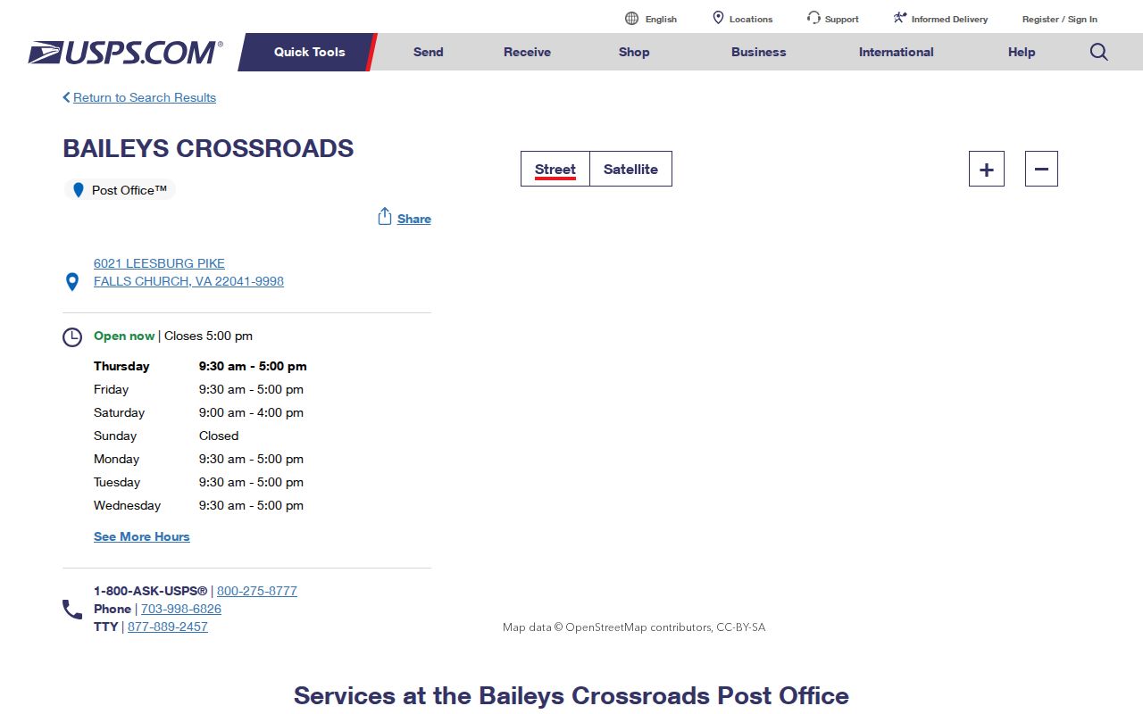
The postal result is an address check, not evidence of ownership, occupancy, precinct, or city boundary. Record the complete address supplied to USPS alongside the date of the search.
Bailey's Crossroads ZIP and Precinct Check
Precinct 501 BAILEYS sits in Mason District, but a ZIP does not assign a precinct. The research description places it from the Columbia Pike and Seminary Road context toward the City of Alexandria boundary, Holmes Run, and Columbia Pike. Its polling location is Minnie H. Peyton Community Center at 5920 Summers Lane. Because precinct changes occurred in 2003, 2021, 2022, and 2024, confirm a current address against the Fairfax precinct page or the current county map.
For Bailey's Crossroads records, keep ZIP, postal city, CDP, precinct, supervisor district, subdivision, parcel, and planning area in separate fields. The Virginia voter portal also has authorization requirements for individual lookup, so it cannot be used as a ZIP-based household list. Election records support a limited civic record question, not a claim about present occupancy.
Note: Election geography should be dated, because precinct boundaries and polling places can change after a ZIP was assigned.
Bailey's Crossroads ZIP Code Boundary Limits
Postal and governmental boundaries do not align in Bailey's Crossroads. 22041 is the core local delivery area, but 22044 and 22042 can enter a search through shared or nearby corridors. A Falls Church mailing line can still be Fairfax County, and 22046 is the independent city's primary ZIP rather than a default Bailey's Crossroads result. For each address, use USPS for delivery, MAR for jurisdiction and active-address status, iCare for the parcel, and the appropriate county map for precinct or planning questions.
- ZIP and ZIP+4
- The five-digit ZIP identifies a delivery area; ZIP+4 adds a more specific delivery segment for the supplied address.
- PO-box ZIP
- A ZIP used for post-office boxes rather than a geographic set of street-delivery addresses.
- Unique ZIP
- A ZIP assigned to one large organization or address. The research did not identify one as a Bailey's Crossroads default.
- Carrier route
- A postal delivery grouping used for mail handling. It is not a city, parcel, or census boundary.
A Falls Church address-finder result is shown below. It illustrates why the original mailing city needs a separate county-jurisdiction check for a Bailey's Crossroads ZIP directory search.
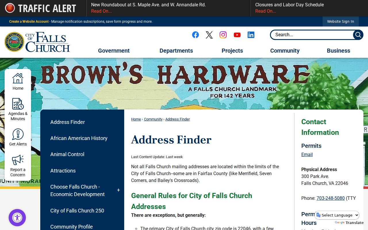
Use the city finder as a jurisdiction warning, then verify the exact Bailey's Crossroads address in MAR or iCare before attaching any county record.
Bailey's Crossroads ZIP Record Routes
When an online result is incomplete, Bailey's Crossroads ZIP research has several documented routes. USPS handles delivery questions. Fairfax GIS and the Department of Tax Administration handle county address and parcel questions. Elections handles precinct information. Virginia Room maps, directories, and newspapers add historical context, while the Historic Records Center and Library of Virginia hold older maps and county material. A defined VFOIA request may seek an existing county address or precinct record, but it cannot require the county to create a USPS boundary crosswalk.
Keep the exact address, reason, and date together when contacting an office. The Bailey's Crossroads Post Office phone is 703-998-6826, Fairfax GIS lists 703-324-2712 and 703-324-7329, and Fairfax Elections lists 703-222-0776. For a historic map or prior label, use the Virginia Room, HRC, or LVA route and identify the collection and year needed.